
Monroe ZIP Code Directory Coverage
Monroe has two postal codes that serve the city. Each also reaches outside the municipal line, which makes each code useful for delivery and search narrowing but not for deciding city jurisdiction. The county's adopted parks and trails plan is the clearest local source for the coverage pattern. Use the postal service to verify one address, then use parcel and municipal records to determine which government body or record keeper applies.
| ZIP | Areas Covered | Postal Route | Notes |
|---|---|---|---|
| 48161 | City of Monroe and portions of Monroe and Raisinville Townships | Monroe Post Office, 210 W Front Street, Monroe, MI 48161-9998 | Its postal area extends beyond the city limit. |
| 48162 | City of Monroe and portions of Frenchtown and Raisinville Townships | Monroe postal service; the main physical office address is in 48161 | A Monroe mailing city can still be outside the City of Monroe. |
Only 48161 and 48162 belong in this City of Monroe directory. The county plan names several nearby ZIPs, but they serve neighboring areas rather than adding more city ZIPs. City addresses demonstrate local use of both codes, including a downtown fire station in 48161 and a North Custer station in 48162. Those examples confirm use, not the full delivery boundary. The address-level check remains the safest way to resolve an individual record.
USPS Checks for Monroe Postal Codes
The USPS address lookup has two useful paths. Find by Address verifies the delivery ZIP for a precise address. Find City & State returns city, state, and ZIP combinations. Use the first route before adding a ZIP to a parcel, deed, or public-record query. The Michigan statewide boundary map is approximate, so it cannot replace the address-level postal result.
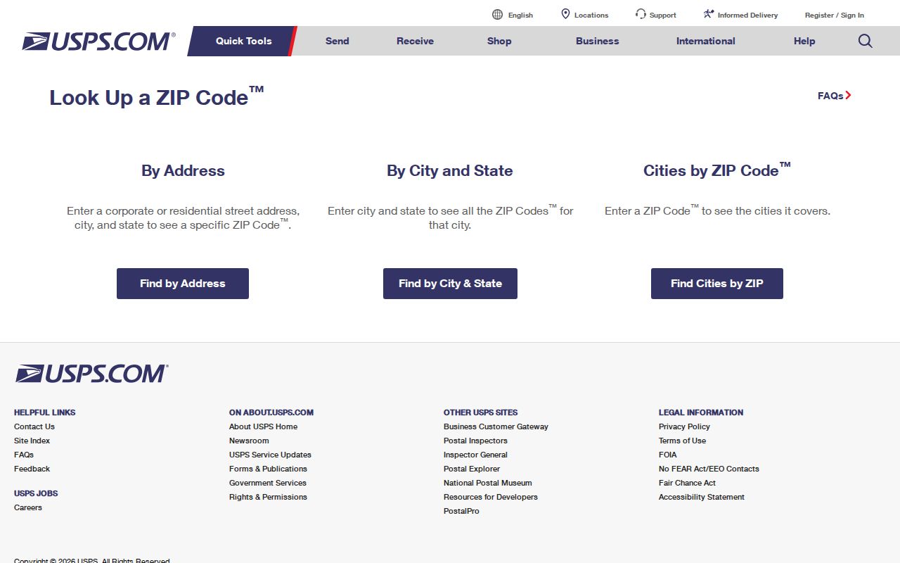
The USPS screen is the delivery check, not a land-jurisdiction map. After confirming the postal result, compare it with the Monroe County parcel viewer and the assessment record. This avoids a common mismatch where a mailing label says Monroe even though the parcel lies in Monroe Township, Raisinville Township, or Frenchtown Township. Record the result with its source date and the kind of geography it represents.
Monroe Postal Search Fields
Different Monroe portals accept ZIP information in different ways. A ZIP in a property or deed search usually narrows an address-based result. It does not create a complete citywide list of people. The county map's ZIP layer is useful geographic context, while the voter file uses governmental geography such as county, jurisdiction, district, school, ward, and precinct instead of a confirmed public ZIP-wide roster. Keep that distinction in mind before treating a search result as a list of residents.
| Portal | ZIP field or mode | What the result means |
|---|---|---|
| BS&A Online | Address search can include a ZIP or full address; exact advanced labels were not fully exposed. | Property records matching address, owner, or parcel criteria, not a city boundary. |
| Fidlar Direct Search | Address tab includes Zipcode with House No, Street, and City. | Indexed recorded instruments where configured; deed staff still cannot search ownership by address. |
| Monroe County Parcel Viewer | ZIP Codes layer. | Map context only; it is not a USPS delivery guarantee or legal survey. |
| MVIC and QVF | Jurisdiction and other electoral geography, not a confirmed simple ZIP roster. | Registration information or a lawful request subject to sensitive-field redactions. |
BS&A also offers address, name, and parcel-number modes, with detailed, current-tax, delinquent-tax, and assessing routes. A result can include the parcel, owner or taxpayer, situs and mailing context, assessed values, legal description, sale details, and other property-card fields. The mailing address may be elsewhere. It is a correspondence clue, not proof that the owner is present at the Monroe parcel.
Finding Monroe Residents by Postal Code
A ZIP can organize a careful records search, but the search must narrow from delivery geography to a real record key. Start with a full address when possible. Then identify the parcel and municipality before looking at deeds or electoral geography. This method does not turn a postal code into a roster. It keeps every step tied to the kind of evidence that the selected portal actually supplies.
- Verify the exact address with USPS and save the delivery ZIP as a postal fact.
- Use BS&A by address or parcel number to identify the situs, owner or taxpayer field, legal description, and assessment context.
- Open the county parcel viewer to compare the parcel with municipal boundaries and the ZIP Codes layer.
- Use Fidlar by party name, parcel, legal description, or its address tab where available. Read grantor, grantee, instrument, and legal description together.
- For voter information, use the individual's MVIC route or a lawful QVF request by the available governmental geography. Do not assume that ZIP is a QVF roster field.
Once a ZIP leads to a particular street, the Monroe by-street directory has the fuller address-to-parcel and deed-chain process. ZIP geography is the starting filter here; a street or parcel is the better key for examining one property record at a time.
Monroe Postal Lines and City Limits
A Monroe mailing address or ZIP does not prove that an address sits within the City of Monroe. Both local ZIPs extend into townships, and municipal records use the parcel and boundary layer rather than the postal line. Check the county viewer's municipality layer, then confirm the parcel jurisdiction and legal description. This matters when choosing between city departments, township records, county services, or a state custodian.
The same caution applies to public voter geography. MVIC provides an individual's registration, polling, ballot, and clerk information, while the QVF request form offers choices such as county, jurisdiction, district, school, ward, and precinct. The public voter file withholds sensitive details, including full month and day of birth, ID numbers, phone, email, digitized signature, and the last four digits of a Social Security number. A ZIP code is neither a city-limit test nor a license to infer protected data.
Note: Monroe has six city precincts in official election material, but precinct boundaries are not neighborhood boundaries and should not be used as a substitute for parcel jurisdiction.
Monroe Postal and Parcel Keys
Four address keys can appear in one Monroe record trail. Read them separately, especially when an owner receives tax mail elsewhere or a historic record uses a legal description instead of a present street number. The parcel number and legal description are often the stronger bridge between an older document, a current address, and the postal directory. This is especially true for French Claims and private claims near the River Raisin, where older parcels can be narrow strips rather than a regular section-grid pattern.
- ZIP and ZIP+4
- A ZIP identifies a delivery area; ZIP+4 adds a more specific delivery segment. USPS verifies both for a precise address.
- PO-box ZIP
- A ZIP assigned for post-office-box delivery. Do not assume a physical street area from that postal designation.
- Unique ZIP
- A delivery ZIP assigned to one institution or organization. No such Monroe city ZIP is established in the reviewed sources.
- Carrier route
- A postal delivery route used to organize mail. It is not a municipal-boundary or parcel-jurisdiction field.
- Situs and mailing address
- The situs is the physical parcel location; the mailing address is where tax or official correspondence is sent and can be elsewhere.
- Legal description
- The lot, block, subdivision, metes-and-bounds, or French Claim description used to identify land in recorded documents.
A formal Monroe-wide renumbering or renaming schedule was not located in the reviewed official sources. When an old address fails, compare street variants, ward maps, atlases, the legal description, and grantor or grantee names rather than assuming a documented citywide conversion year. City, county, township, and postal labels need the same caution.
Monroe ZIP Code Records Before ZIPs
Do not force a modern postal code into a Monroe record created before postal ZIPs were used. For a past address, start with the street, ward, legal description, or parcel. Then use the 1860 directory, the cataloged 1916 and selected 1946 to 1960 directory runs, street indexes, atlases, newspapers, census material, city tax rolls, and probate. Historical sources may connect a name to a place and year, but they do not always use the same address format seen in a current parcel record.
Monroe's map and atlas routes include 1859, 1876, 1896, 1901, and 1916 material. The 1896 atlas includes a list of residents with dates of arrival, which can help separate same-name people or explain when a household entered the county. Pair an atlas or directory result with a deed, probate, newspaper, census, or assessment record. Maps give physical context, not a complete list of people at an address.
Monroe Postal Boundary Limits
The county parcel viewer states that its mapped boundaries come from the real-property database and that assessment information is updated biannually. It is provided for browsing and viewing spatial information, not as a legal boundary survey. Contact the local assessor or Monroe County Clerk for a legal-boundary question. If a city or township issue matters, preserve the verified USPS result, the parcel number, municipality layer, and legal description together rather than relying on one map label.
The county's 2025 parks and trails plan remains a useful local correction to the idea that city equals ZIP. It identifies the township extensions of 48161 and 48162 but does not replace the individual USPS lookup. That sequence keeps a Monroe ZIP code directory search grounded in the available record systems and avoids claiming more than each source can show.